
You may have heard about land surveying, but you’re not exactly sure what it is. Maybe you’ve even been told your house needs a survey, but you’re wondering how much it will cost and why. We’ll answer all of these questions and more in this post!
Why Is Land Surveying So Expensive?
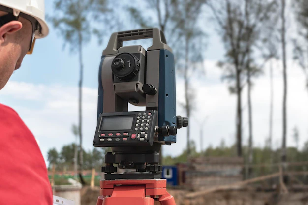
There are a few reasons why land surveying can be so expensive. First, it’s a highly regulated industry. Professional Land surveying in BC is only practised by British Columbia Land Surveyors, licensed professionals trained to use the latest technology and techniques.
Second, it’s a highly skilled profession that requires years of experience to master the skill set needed to do accurate surveys.
Third, since land surveys involve measurements on public lands or private properties that can be dangerous or inaccessible in certain locations (like underwater), they may require specialized equipment and more personnel than other construction projects would need for similar work. Additional costs are also associated with high tech equipment used to conduct the survey, along with the software and licenses needed to process all the survey data.
The Cost Of A Land Survey Depends On Several Factors.
The cost of a land survey depends on several factors. The price is usually determined by the size of the plot, the accuracy required for your specific project and the type of survey (e.g., boundary survey, topographic survey). If you are planning to build a new house or run a utility line through your property, a boundary line or topographic survey will give you accurate information regarding the borders and elevations of your land. This type of survey is necessary if there are any disputes between neighbours or when determining whether someone has encroached onto someone else’s property.
If you need help finding reputable land surveying companies near you that can provide accurate results within your budget, then contact us today!
What Does A Land Surveyor Do?
Land surveyors measure, mark and document the location of boundaries for a property. They also measure and mark the position of existing buildings, utilities and fences and other features such as wells, septic systems and manholes. The information they gather is used to create a map or plans that show the location of these things on your property.
What Sort of Information is in a Land Survey, and Where Do You Get One?
Land surveys provide a lot of information, from boundary lines to easements to rights of way. They also include information about natural land features, like streams and creeks.
- Location information: A survey will show you where your property’s boundaries are and where it is located relative to other landmarks such as roads and rivers.
- Boundary lines: These are lines that show where one piece of real property ends and another begins. In most cases, they will be straight lines running north-to-south or east-to-west; however, some properties may have curved boundaries depending on their shape or how they were created (for example, by purchasing just one corner of an existing tract).
Property corners: An important part of any survey is locating each property corner so that you know exactly what is yours! This can be done differently depending on how many corners each parcel has, and how they form a boundary between your neighbour or fronting road.
Recent Comments