
Land surveying is a critical step in many property and construction projects. Whether you’re buying a new home, developing land, or starting a construction project, working with professional land surveying companies ensures accuracy, compliance, and peace of mind. Homeowners and developers often search Google for “a land surveyor near me” to help define property boundaries, prepare legal documents, or plan future construction projects. To better understand how this process works, let’s break down the land surveying process step by step.
Step 1: Initial Consultation and Project Scope
The process begins with a consultation between the client and the surveyor. During this stage, the land surveyor, whether in Coquitlam, Surrey, Maple Ridge, or Vancouver, will contact residents to gather information about the survey’s purpose. Is it for a new fence installation, subdivision planning, or a property purchase? Defining the scope helps the surveyor determine the type of survey required, such as boundary, topographic, or construction surveys.
Step 2: Research and Record Review
Before setting foot on your property, BC land surveyors review historical records, maps, and previous surveys. They examine land titles, deeds, and municipal archives to understand property boundaries and legal descriptions. This background research is essential to avoid disputes and ensure the surveyor works with the most accurate information available.
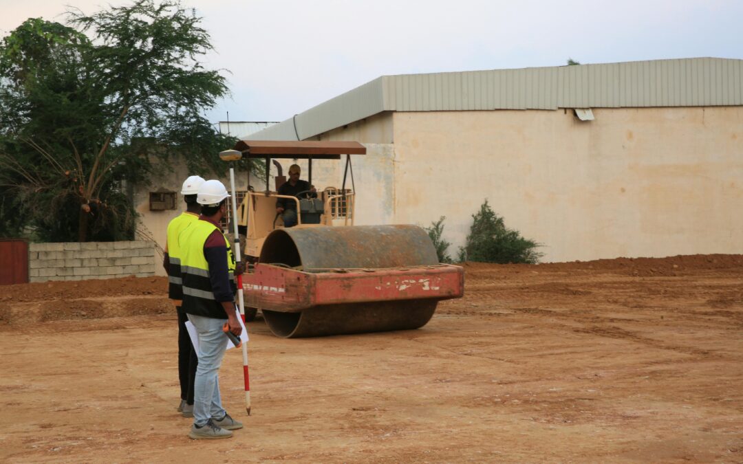
Step 3: Fieldwork and On-Site Measurements
Next comes the fieldwork stage, where surveyors utilize advanced tools, including GPS, drones, and total stations, to take precise measurements. If you’re working with experts in land surveying in Coquitlam or nearby areas, you’ll notice they combine traditional techniques with modern technology to deliver reliable results. The surveyor marks boundaries, collects elevation data, and notes natural and man-made features that impact the property.
Step 4: Data Analysis and Calculations
After field data is collected, it is processed and analyzed back in the office. Land surveying companies use specialized software to interpret the data, ensuring all measurements align with legal boundaries. This stage requires precision, as even minor errors can lead to costly disputes or construction delays.
Step 5: Creating Maps and Reports
Once the analysis is complete, the surveyor prepares detailed maps, drawings, and reports. These documents show exact property boundaries, easements, and features. If you’re working with a land surveyor in Coquitlam or another local expert, these deliverables can be used for municipal approvals, real estate transactions, or construction planning.
Step 6: Final Plans and Official Filing
Finally, the surveyor reviews the results and finalizes plans. Depending on the project, results may also be submitted to municipalities, legal professionals, or engineering teams. This final step ensures all stakeholders have accurate information to move forward confidently.
Why Professional Land Surveying Matters
Whether you need land surveying in Coquitlam or are searching for a trusted land surveyor, choosing qualified professionals is key. BC land surveyors are licensed experts who understand both local regulations and technical requirements. By following this step-by-step process, they ensure your property is clearly defined, legally compliant, and ready for future projects.
Start Your Project with Trusted Land Surveying Experts in the East at Target Land Surveying
Looking for reliable BC land surveyors to guide your next project? Our team specializes in precise measurements, detailed reports, and exceptional service. Whether you need a land surveyor in Coquitlam, Port Moody, or New Westminster, we’re here to help. Contact us today and let our experts bring clarity and confidence to your property plans.
Recent Comments