
If you are working on a large-scale mapping project, you have to choose the best mapping and survey technology, which can be tricky. Deciding on the most appropriate approach is very important. You should start by determining what accuracy is required for the project and whether the data set will be used for conceptual or detailed design work. These answers will help you make an informed decision, and the following are just some of the solutions you can consider for your project:
Real-time Kinematic Surveying
Typically this is done using 2 survey grade receivers where one is known as your base station and the other the rover. The base station has known coordinates while your rover is used to survey in features at a to-be-determined location. The base station sends corrections to the rover enabling the high precision surveying results. Additionally, the GPS receivers can be mounted to an ATV or other vehicles and collect measurements while the car is in motion at defined times or distance intervals.
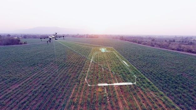
Drone Surveying
This would allow you to cover big areas quickly, and drone mapping would allow you to do this with a high level of accuracy. Unmanned aerial vehicle or unmanned aerial system photogrammetry mapping are the two main types of aerial mapping services, and photogrammetry helps create 3D models from photographs. This type of mapping makes it possible to accurately map hundreds of acres of land in just one day because of recent advancements, so it is being used for mapping mines, gravel pits and construction sites. Mounting a camera on an aerial vehicle will allow you to collect hundreds of images per acre, and these can later be stitched together using specialized software.
Unmanned Aerial Vehicle or Unmanned Aerial System LiDAR Mapping
This consists of a remote sensing technique and stands for light detection and ranging. Pulsed laser beams are used in this method to measure ranges to the earth’s surface. LiDAR is capable of penetration tree canopies enabling measurements to the ground surface in forested areas.
Bathymetric Surveying
These techniques would allow you to map the underwater surface of a waterbody, so you would be able to produce a very accurate mapping of the floor to determine important information like elevation changes or anomalies of the seafloor and sediment build-up locations, for example.
Topographical Surveying and Mapping
This 2-dimensional plan view representation would show the elevations and surface features of a piece of land. Contour lines, surface and manufactured features and environmental and water features are the main components of a topographical map.
A lot of large-scale mapping projects use a combination of survey technologies, and it is a must that you hire the right company so that they can help you with all of your mapping needs. Target Land Surveying in BC is a professional and reputable firm, and our knowledgeable team can help with your next land surveying project. If you are looking for land surveyors in the Langley or Vancouver areas, contact us today!
Recent Comments